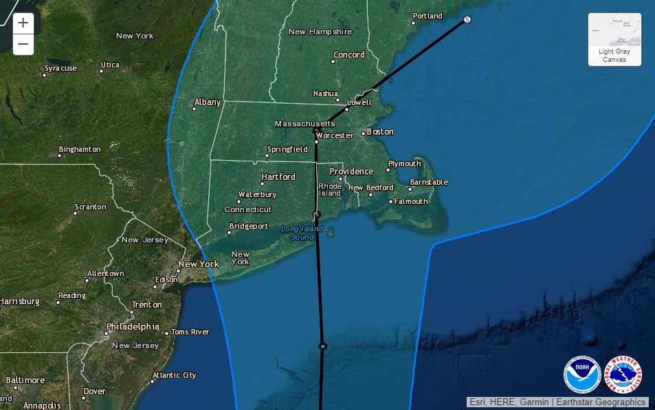
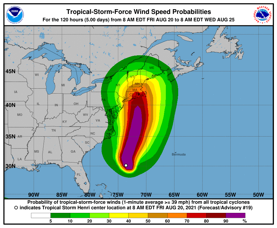
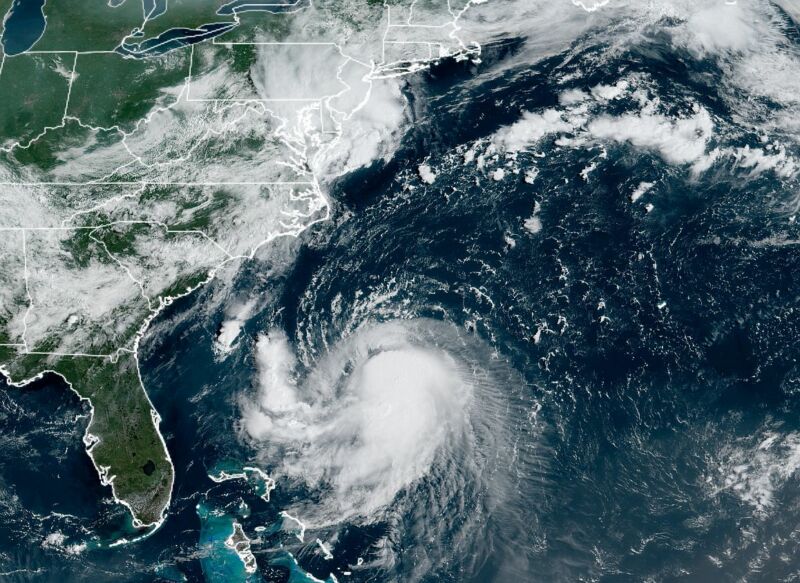
After several days of uncertainty and wild swings in forecast models, confidence is increasing in a large tropical system making landfall in the northeastern United States this weekend. In addition to causing surges along the coastline, Henri could bring gusty winds and widespread heavy rainfall from late Saturday through Monday to a region from New Jersey to Maine.
The latest forecast from the National Hurricane Center, issued at 11 am ET on Friday, shows Henri holding at sustained winds of 65 mph, just below hurricane strength. However, the wind shear hampering Henri's organization should relax some later today, and as the storm passes over the Gulf Stream, forecasters anticipate Henri will become a Category 1 or 2 hurricane. It may weaken some before landfall, however, as it passes over the cooler waters off the coast of New England.

Over the next 48 hours, the storm should now move more or less due north and will likely make landfall somewhere along Long Island, Connecticut, or Rhode Island on Sunday.
The tweet below, from meteorologist Tomer Burg, shows how a "super-ensemble" forecast incorporating a range of outputs from the premier US and European forecast models has shifted from significant uncertainty on Wednesday evening to a tighter clustering as of Friday morning. This clustering of ensemble model forecasts is one reason confidence is now higher in the track for Henri.
Regardless of its precise landfall location or intensity, Henri will bring substantial impacts to the United States this weekend. These threats include coastal flooding, wind damage, and, perhaps most concerning, inland flooding.
Flooding is likely for two reasons. First, much of New England has already experienced a wet July, and the region recently received rainfall from the remains of Tropical Storm Fred. Soil moisture across parts of New York and the New England states is at the 90th percentile level or higher. Second, Henri is forecast to move relatively slowly as it approaches Long Island and the New England coasts this weekend, probably 10 mph or less, prolonging the period of heavier rainfall.
An average of 2 to 6 inches of rain from Henri, with higher isolated totals falling on already soggy ground, could lead to road and stream flooding. The situation will also increase the potential for trees with shallow roots in softer ground to blow down in stronger wind gusts.

Henri is the eighth named storm of the 2021 Atlantic season and continues what has been a fairly busy season. Only two other years since there have been reliable satellite observations, which date back to 1966, have had eight or more named storms formed by the middle of August. These were the incredibly active years of 2005 and 2020.
Fortunately, the next week looks reasonably quiet in the tropics for late August. Although a storm may form in the Central Atlantic, it is highly likely to recurve northward before threatening any land. The next area of interest close to land may come in the western Gulf of Mexico about 10 days from now.


3175x175(CURRENT).thumb.jpg.b05acc060982b36f5891ba728e6d953c.jpg)

Recommended Comments
There are no comments to display.
Join the conversation
You can post now and register later. If you have an account, sign in now to post with your account.
Note: Your post will require moderator approval before it will be visible.