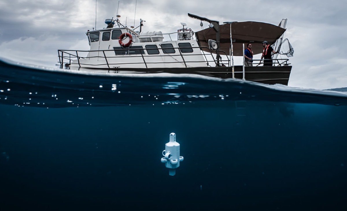
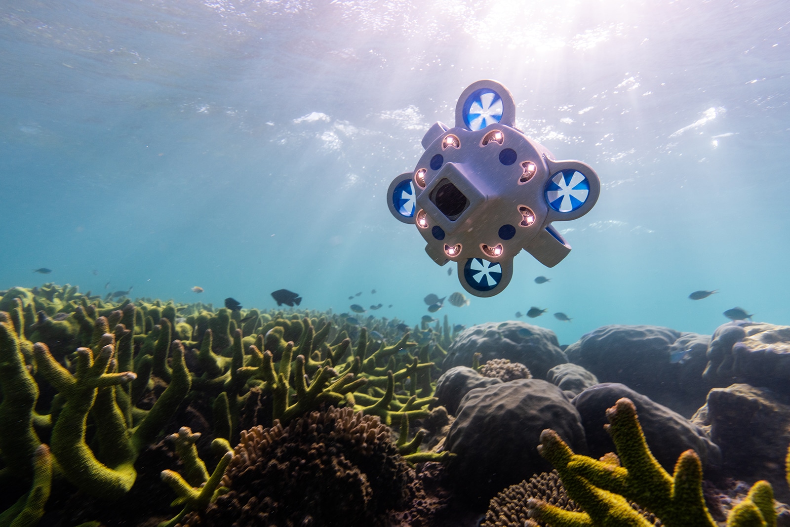
A small underwater drone called Hydrus has located the wreckage of a 100-year-old coal hulk in the deep waters off the coast of western Australia. Based on the data the drone captured, scientists were able to use photogrammetry to virtually "rebuild" the 210-foot ship into a 3D model (above). You can explore an interactive 3D rendering of the wreckage here.
The use of robotic submersibles to locate and explore historic shipwrecks is well established. For instance, researchers relied on remotely operated vehicles (ROVs) to study the wreckage of the HMS Terror, Captain Sir John S. Franklin's doomed Arctic expedition to cross the Northwest Passage in 1846. In 2007, a pair of brothers (printers based in Norfolk) discovered the wreck of the Gloucester, which ran aground on a sandbank off the coast of Norfolk in 1682 and sank within the hour. Among the passengers was James Stuart, Duke of York and future King James II of England, who escaped in a small boat just before the ship sank.
In 2022, the Falklands Maritime Heritage Trust and National Geographic announced the discovery of British explorer Sir Ernest Shackleton's ship Endurance. In 1915, Shackleton and his crew were stranded for months on the Antarctic ice after the ship was crushed by pack ice and sank into the freezing depths of the Weddell Sea. The wreckage was found nearly 107 years later, 3,008 meters down, roughly four miles (6.4 km) south of the ship's last recorded position. The wreck was in pristine condition partly because of the lack of wood-eating microbes in those waters. In fact, the lettering "ENDURANCE" was clearly visible in shots of the stern.
And just last year, an ROV was used to verify the discovery of the wreckage of a schooner barge called Ironton, which collided with a Great Lakes freighter called Ohio in Lake Huron's infamous "Shipwreck Alley" in 1894. The wreck was so well-preserved in the frigid waters of the Great Lakes that its three masts were still standing and its rigging still attached. That discovery could help resolve unanswered questions about the ship's final hours.

According to Advanced Navigation, there are some 3 million undiscovered shipwrecks around the world—1,819 recorded wrecks lying off the coast of Western Australia alone. That includes the Rottnest ship graveyard just southwest of Rottnest Island, with a seabed some 50 to 200 meters below sea level (164 to 656 feet). The island is known for the number of ships wrecked near its shore since the 17th century. The Rottnest graveyard is more of a dump site for scuttling obsolete ships, at least 47 of which would be considered historically significant.
However, this kind of deep ocean exploration can be both time-consuming and expensive, particularly at depths of more than 50 meters (164 feet). Hydrus was designed to reduce the cost of this kind of ocean exploration significantly. One person can deploy the drone because of its compact size, so there is no need for large vessels or complicated launch systems. And Hydrus can capture georeferenced 4K video and still images at the same time. Once this latest expedition realized they had found a shipwreck, they were able to deploy a pair of the drones to take a complete survey in just five hours.
Hydrus captured this footage of the 210-foot wreck of a 19th-century coal hulk. Credit: Advanced Navigation
Ross Anderson, curator of the Western Australia Museum, was able to identify the wreck as an iron coal hulk once used in Freemantle Port to service steamships, probably built in the 1860s–1890s and scuttled in the graveyard sometime in the 1920s. The geolocation data provided to scientists at Curtin University HIVE enabled them to use photogrammetry to convert that data into a 3D digital model. "It can't be overstated how much this structure in data assists with constraining feature matching and reducing the processing time, especially in large datasets," Andrew Woods, a professor at the university, said in a statement.
The expedition team's next target using the Hydrus technology is the wreck of the luxury passenger steamship SS Koombana, which disappeared somewhere off Port Hedland en route to Broome during a tropical cyclone in 1912, with 150 on board presumed to have perished. The only wreckage recovered at the time was part of a starboard bow planking, a stateroom door, a panel from the promenade deck, and a few air tanks. There were a couple of reports in the 1980s of "magnetic anomalies" in the seabed off Bedout Island, part of the route the Koombana would have taken. But despite several deep-water expeditions in the early 2010s, to date the actual shipwreck has not been found.
Listing image by Advanced Navigation


3175x175(CURRENT).thumb.jpg.b05acc060982b36f5891ba728e6d953c.jpg)
Recommended Comments
There are no comments to display.
Join the conversation
You can post now and register later. If you have an account, sign in now to post with your account.
Note: Your post will require moderator approval before it will be visible.