
Deforestation in tropical South America extends beyond the Amazon basin.
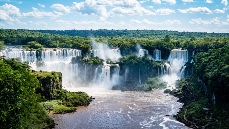
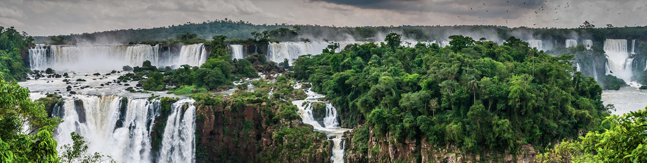
The Iguassu Waterfall and nearby forests straddle Argentina, Brazil, and Paraguay.
Deforestation not only causes the loss of important natural resources, it also contributes to global warming. Deforestation is the cause of about 20 percent of carbon dioxide emissions globally, which is higher than both passenger vehicles and trucks emit.
Large-scale deforestation of the Amazon began several decades ago and has accelerated in recent years, placing Brazil among the countries with the most. But the loss of forests in South America is not an Amazon-specific issue. According to a recent report released by MapBiomas, Argentina has lost almost 20 percent of the Atlantic Forest in the last 37 years.
The Atlantic Forest
The Atlantic Forest is a region shared among Argentina (3 percent), Brazil (90 percent), and Paraguay (7 percent). It is composed of tropical and subtropical rainforests extending more than 3,000 kilometers along the Brazilian Atlantic coast and runs inland to the west for almost 1,000 kilometers from the sea, reaching Northeast Argentina and Eastern Paraguay.
This complex eco-region is home to beautiful natural scenery and boasts an incredible biological wealth as well as a rich cultural diversity with 150 million inhabitants—about one-third of the population of South America.
This forest keeps alive a surprising diversity of life forms, with 7 percent of the planet’s plant species and 5 percent of vertebrate species living here. The importance of this eco-region for global biodiversity and people is remarkable, and it provides the goods and services for the livelihood and well-being of the inhabitants.
In the last 40 years, the area of the Atlantic Forests has been significantly reduced; today, only 20 percent of the original forest remains. More than 80 percent of the original area has experienced some deforestation, threatening many plant and animal species with extinction. This makes it one of the most threatened subtropical forests in the world.
Despite the fact that it has a third of its native vegetation, the Atlantic Forest remains particularly rich in biodiversity and endemic species, many of which are threatened with extinction.
MapBiomas, an evolving platform
That decline makes the Atlantic Forests a major focus of MapBiomas, a network of NGOs, research institutions, and technology startups that produces and promotes the use of high-quality data on land use and land cover management in South America and other tropical regions. The network collects data, information, methods, and tools to improve the decision-making process for conservation and sustainable management of natural resources.
The MapBiomas Trinational Atlantic Forest is one of the ongoing initiatives that are currently part of the MapBiomas network (the rest being Brazil, Amazonia, Chaco, Pampa Trinational, and Indonesia) in which a group of experts in cartography, environmental management, geography, and remote-sensing from Argentina, Brazil, and Paraguay generated the land cover and land use maps of the Atlantic Forest, starting with data from 1985.
The details of the work were released in early October 2022 at a regional conference. The new edition, MapBiomas Trinational Atlantic Forest 2.0, is the outcome of a collaborative network of specialists in areas such as land use, satellite remote sensing, Geographic Information Systems (GIS), and programming.
Through the Trinational Atlantic Forest platform, annual land cover and land use maps were created covering the years from 1985 to 2021. The new collection of maps showed that the biome lost 11 percent of its native vegetation in the past 37 years. In Argentina specifically, 300,000 hectares of forest were lost, meaning that almost 20 percent of the forests that existed in 1985 are now gone—an average rate of 8,000 hectares per year, an area equivalent to more than 11,000 soccer fields. The land occupied by these ecosystems is now used for agriculture, forestry, and pastures. The largest change was in the area occupied by forest plantations, which went from 130,000 hectares in 1985 to 330,000 hectares in 2021.
What the data shows
Ana Eljall, a specialist in socio-environmental information management at Argentine Wildlife Foundation, introduced the latest work. She highlighted the major changes in land cover and land use between 1985 and 2021, noting that, even before 1985, the biome was already transformed, having lost more than 50 percent of its forests.
“Understanding what is happening with the forests is fundamental in this biome. But with the tool we seek to go beyond that and produce information that allows us to analyze land use,” she said. “It is important to understand the dynamics of the territory, the changes, so that later, with other types of information and knowledge, we can look for the best tools to make decisions."
IBS (Institute of Subtropical Biology, National University of Misiones) fellow María Eugenia Iezzi presented details about the research carried out at the institute on the delayed responses of biodiversity to land-use change. She talked about the concept of “Extinction Debt,” where species loss does not occur immediately after habitat loss but follows over time—a challenge for conservation efforts. She highlighted how the data obtained through MapBiomas is very useful for this type of analysis: “There are effects of historical changes in biodiversity on land use. Species are being lost with habitat change; we see the reflection of what happened in the past,” she said.
As for the Argentine Atlantic Forest, she added: “…We see a community today that is a reflection of what happened in the past, not necessarily what is happening today, as there is a delayed response. One of the ways to measure extinction or delayed response is whether the current community correlates better with past landscape situations than with present ones.”
Another participant was Andrés Leszczuk, a doctoral fellow at the Faculty of Forestry Sciences of the National University of Misiones, who described how they used MapBiomas collections for a study on fires between 2021 and 2022 in the province of Misiones, which is suffering a severe drought.
Impact on public policies
Beyond Argentina, the Atlantic Forest, the ecosystem that borders the Brazilian coastline and one of the most threatened tropical biomes in the world, today has less than a quarter of its original native vegetation, said Marcos Rosa, technical coordinator of MapBiomas Brazil. “The purpose [of our work] is to reveal the transformations of the territory through science, with precision and quality, and to make possible the access to knowledge about land cover and land use in order to seek conservation and sustainable management of natural resources in the face of climate change,” he added.
The human impact on this eco-region has several causes: land use for agriculture; the conversion of forest to cattle pastures; hunting and harvesting of species; logging and the increase in forest heating and desiccation; and fires caused by human activity. The shrinking of forests means fewer trees to absorb carbon from the atmosphere, enhancing climate change and increasing the risk of future problems.
Most of the original forest habitat has been lost and replaced by human-modified landscapes, including pastures, croplands, and urban areas. The conversion of natural environments, deforestation, and forest fragmentation are the main threats to key species, such as jaguars, the largest feline on the American continent. At the same time, the natural resources that sustain the livelihoods of local and native populations are at risk.
The MapBiomas Trinational Atlantic Forest initiative is intended to help countries identify and manage threats to this ecosystem. It started in November 2019 as a geographic extension of the MapBiomas Brazil project. The first collection included maps from the period 2000 to 2019, tracking 12 categories of land-cover and land-use changes. Now, the update goes back to 1985 and extends to 2021, with 18 land-cover and land-use classes.
The project uses Landsat satellite imagery (with a resolution of 30 by 30 meters) and cloud processing through the Google Earth Engine platform to produce annual land-cover and land-use maps. The machine-learning algorithms available through the Google Earth Engine platform offered the researchers an immense processing capability in the cloud to generate the maps of coverage and land use and identify changes that occur over time.
Landsat-based annual maps allowed the researchers to identify natural woody vegetation, natural herbaceous vegetation, dispersed natural vegetation, cropland, pastures, bare areas, and water.
The imagery data used in the collection was obtained by different Landsat sensors: Thematic Mapper (TM), Enhanced Thematic Mapper Plus (ETM+), and the Operational Land Imager and Thermal Infrared Sensor (OLI-TIRS) on board Landsat 5, Landsat 7, and Landsat 8, respectively. The Landsat imagery collections were originally obtained by NASA and the USGS and made available via Google Earth Engine.
The Atlantic Forest Collection 2.0 includes some improvements in the identification of landscape status and use, and it now includes annual land cover maps for the Atlantic Forest in Argentina and Paraguay. Other biomes located around the region were partially included to allow better regional integration.
Providing a public platform for this data is vital to landscape management. By taking advantage of it, field activities can be organized to identify critical areas where deforestation needs to be stopped urgently. These can include patches of forest that are becoming disconnected, where restoration actions are considered necessary to establish ecological corridors so as to conserve essential ecosystem services for people and habitat for many species.
- aum and Matt
-
 2
2
Recommended Comments
Join the conversation
You can post now and register later. If you have an account, sign in now to post with your account.
Note: Your post will require moderator approval before it will be visible.